West Kelowna’s Rose Valley being evacuated due to wildfire
West Kelowna #WestKelowna
UPDATE 6:05 p.m.
The BC Wildfire Service has updated the size estimate of the McDougall Creek wildfire to 1,100 hectares.
The agency did not release any additional details. The fire was estimated at 64 hectares this morning.
UPDATE 5:35 p.m.
Central Okanagan Emergency Operations has issued formal evacuation orders to 143 more properties in the Bartley Road area and 620 properties in the Rose Valley neighbourhood.
“Tactical evacuation is already underway,” said the regional district.
An interactive map of evacuation zones is here.
Residents on evacuation order must leave the area immediately.
“To ensure an orderly evacuation of these areas, please follow directions from emergency personnel. Public safety and the protection of critical infrastructure are the primary concerns,” said the regional district.
Evacuees should register online or attend the Information Centre at Royal LePage Place, 2760 Cameron Road in West Kelowna.
Central Okanagan Emergency Operations says BC Wildfire will provide an update mid-morning Friday. Additional information will be shared in this story as it is known.
Recently added properties under evacuation order include all properties on Bartley Road north of Shannon Lake Road including:
All of the Rose Valley subdivision was also recently added to the Evacuation Order area including:
Areas north of Westlake Rd and Parkinson Rd were also recently added to the evacuation order area including:
All other properties on evacuation alert and order remain in place.

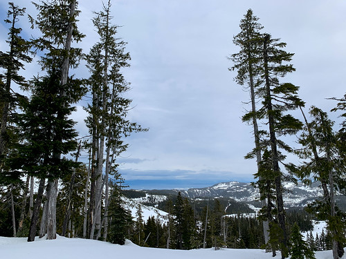
Photo: Nicholas Johansen
Police block evacuation zone in Rose Valley.
UPDATE 4:55 p.m.
New evacuation orders have been issued for the Bartley and Lenz Road areas of West Kelowna.
RCMP are going door to door telling residents to leave.
Central Okanagan Emergency Operations has updated its evacuation map here to include the new evacuation zone.
The Emergency Operations Centre says some tactical evacuations are also starting in the Rose Valley neighbourhood.
The EOC says a full announcement and news release is imminent.

Photo: Madison Reeve
RCMP are on Lenz Road issuing evacuation orders.
UPDATE 3:45 p.m.
People ordered to leave their homes as a result of the McDougall Creek wildfire are being asked to try and find accommodations with family and friends.
According to the Emergency Operations Centre, hotels and motels in the area are busy for the summer. While some hotels may have space for evacuees, people who have friends and family in the area are asked to seek those avenues first.
At the present time, 68 properties have been placed on evacuation order. Those addresses are available on the initial story below.
EOC officials say they are looking into group options including utilizing the assistance of the Central Okanagan School District.
SD 23 Supt. Kevin Kaardal says the school district has been working with the EOC to set up an emergency lodging site.
The school district has supported the EOC during several previous evacuation events.
West Kelowna Fire Chief Jason Brolund says further evacuations are possible as winds pick up across the region.
The 300-hectare fire was last estimated at two to four kilometres from homes.
Madison Reeve
UPDATE: 3:15 p.m.
The wind is picking up in the Okanagan Valley.
By 2 p.m. it was already gusting to 40 km/h in Penticton and making its way north towards West Kelowna and the McDougall Creek fire.
“The ridgetops are starting to show some signs as well of wind picking up. That’s all going to gradually, through the late afternoon, evening hours we’re going to be seeing gusts generally–the public might see 20 to 40 km/h but we’re looking at the ridge tips probably around 50-60 km/h from the west/southwest,” said Environment Canada meteorologist Matt Loney.
Even more worrisome, is the expected shift in the wind direction forecast for tomorrow that could push the fire towards the city.
“The wind will die down a little bit late this evening, but then tomorrow the winds are going to be coming more out of the northwest. The shift will be subtle. The frontal passage will be more subtle, but then it will pick up again in the afternoon, said Loney, who notes that gusts could hit 40-50 km/h on ridge tops Friday.
On top of that, there’s still a 30 per cent risk of thunderstorms, possibly bringing dry lightning.
“So far, the frontal path is further north. We haven’t seen much, if any lightning, so far. Fingers crossed that that continues but we do have a risk as this thing slides further down,” although he says the chance of lightning is more on track for the Columbia and Kootenays, rather than the Okanagan.
“It kind of falls away as it gets further west but, by no means, is the chance zero.”
One bit of positive news is that cooler temperatures are on the way. Unfortunately, the frontal system moving in won’t be packing much moisture. Loney says Environment Canada is not expecting any widespread rainfall in the Okanagan.
UPDATE 1:40 p.m.
Evacuation orders have now been issued for 68 properties as a result of the McDougall Creek wildfire.
The properties affected by the order put in place by the Emergency Operations Centre include properties accessed off of Bear Creek Road to the north of Parkinson Road but not including Parkinson Road itself.
These include:
The evacuation alert imposed Wednesday evening has also been expanded to include areas north of Traders Cove up to, and including Caesars Landing.
More than 5,700 properties are now on evacuation alert. Click here for a map of the area affected.
Bear Creek Provincial Park also remains under an evacuation alert. Campers are advised to be ready to leave the area. Recreation areas within West Kelowna and the Central Okanagan West Electoral Area are under an evacuation order.
Evacuees should register online or attend the information centre at Royal LePage Place on Cameron Road in West Kelowna.
A local state of emergency has also been issued for the City of West Kelowna, Westbank First Nation and the west electoral area.
Madison Reeve
UPDATE 12:55 p.m.
West Kelowna Fire Chief Jason Brolund expects the growing McDougall Creek wildfire to force the evacuation of homes in the area later today.
Following a flight over the large wildfire Thursday afternoon, Brolund said the fire poses a risk to the community, and he expects some of the evacuation alerts to turn to evacuation orders at some point today.
“I expect today that we will see evacuation orders, not for the entire alert area but for portions of it, the portions that we deem most at risk,” Brolund said.
Late Wednesday evening, 4,800 homes were placed on evacuation alert, impacting about 10,000 people. Brolund said there are a number of rural properties and cabins north of the many subdivisions in the area that could face evacuation orders first.
He was unable to say when evacuation orders may go in effect, saying it depends on the ferocity of the winds.
Brolund said the now 300-hectare fire has been growing away from the community, but a switch in wind direction expected later today could cause it to move towards homes.
Currently, he said the fire is about two to four kilometres away from homes. He noted that sprinklers and other structure protection apparatus could be put in place once homes are evacuated from areas.
“The conditions today, this morning, are very challenging already and we expect the winds will increase, which will increase the size of the fire,” Brolund said, adding that his concern is “very high.”
“It has the potential to be a very big fire burning right on our doorstep and it likely will be by the end of the day.”
Earlier today, BC Wildfire Service Director Cliff Chapman said the McDougall Creek fire was showing extreme fire behaviour early Thursday morning.
“We are seeing extreme fire behaviour on that fire, as of 7 o’clock this morning,” he said. “It just indicates the condition the forests are in right now, how dry it is up there. We rarely see hat type of fire behaviour pre-breakfast time in B.C., and we’re seeing it today and we’re going see it continue through today.”
Air tankers are currently hitting the large fire, but Chapman said their suppression efforts would “be tested.”

Photo: Madison Reeve
A large plume over West Kelowna from the McDougall Creek wildfire.
UPDATE 11 a.m.
The McDougall Creek Wildfire burning above Rose Valley has now grown to 300 hectares in size.
Kamloops fire information officer Taylor Wallace says heavy smoke and poor visibility in the area Wednesday did not allow aircraft to get an accurate reading on the size of the fire. The size is up from 64 hectares this morning.
BC Wildfire says the fire remains approximately 10 kilometres from West Kelowna.
According to Wallace, 21 ground personnel at the fire are working mainly along the northwest flank of the fire where they are seeing Rank 3 fire activity which is a moderately vigorous ground fire.
Three helicopters and air tankers are working from above.
West Kelowna Fire Chief Jason Brolund is touring the fire by helicopter. Castanet will speak with Brolund at noon.
UPDATE 10 a.m.
According to the latest information from the BC Wildfire Service, the McDougall Creek wildfire remains mapped at 64 hectares in size.
The fire, which was initially spotted late Monday afternoon remains about 10 kilometres northwest of West Kelowna above Rose Valley.
Visibility has remained a challenge due to smoke in the area. Yesterday, the fire was displaying Rank 3 behaviour with pockets of Rank 4, meaning a moderate to highly vigorous surface fire.
Ground crews and air support are again hitting the fire Thursday. Both BCWS and West Kelowna fire crews are working the fire.
Evacuation alerts put in place Wednesday evening for 4,800 properties remains in effect until further notice.

Photo: BCWS
McDougall Creek wildfire
UPDATE 9:42 a.m.
West Kelowna fire chief Jason Brolund wants to remind everyone in West Kelowna who is on evacuation alert to be prepared to leave at a moment’s notice.
“It’s definitely a pretty dynamic situation,” he told Castanet Thursday morning.
“We are really looking at challenging weather conditions for the next 24 hours. We’re watching the winds very closely. And we’re doing everything we can to be prepared.”
He says firefighters will be out in the neighbourhoods today preparing the community.
“There are many different agencies involved at this point, the wildfire service, the RCMP, our public works, just to name a few planning and executing those plans to get our community ready.”
“Should that fire come to town — it is likely that this fire will grow exponentially in the next 12 to 24 hours and we want people to understand, not to panic, but to take the time to get ready,” Brolund said.
Brolund advises people on evacuation alert to use the time to prepare and visit the BC FireSmart website for a list of last-minute things to do in the event of a full evacuation alert being issued.
He says if the evacuation alerts turn into orders, the public should pay attention to emergency notices and information.
“Because it’s likely that it won’t be all at once and people will have to pay close attention. If they’re asked to leave, we need them to leave.”
Brolund said homeowners in interface areas can also be doing last second things around the home to make their properties more resilient to fire. FireSmart tips are here.
The provincial government is holding a wildfire news conference at 11 a.m.

Photo: Jason Pettyjohn
The McDougall Creek fire on Thursday from Upper Sundance Drive in Shannon Lake.
UPDATE 9 a.m.
The Central Okanagan Emergency Operations Centre will be holding a briefing session Thursday morning at 10 a.m. where decision makers including the BC Wildfire Service, West Kelowna Fire and BC Hydro will discuss plans for more than 10,000 residents who have been placed on evacuation alert overnight,
“It is a bit of a weather-driven (event) and it depends on what the winds do, so we’re just we’re planning,” said Central Okanagan Emergency Operations spokesperson Keri O’Rourke.
“We’ve got a great team together for advanced planning, they’re working hard coordinating with all agencies, these are the people that you want in the room when something like that is happening.”
O’Rourke says they will have more info to share after the 10 a.m. meeting.
Despite this only being an evacuation alert CORD, is also advising those who are in the evacuation alert areas to register early in the event that an evacuation order is issued. An interactive map of the evacuation alert area impacting 4,800 properties is here.
Environment Canada is forecasting strong winds this afternoon with the wind becoming southwest 20 km/h and gusting to 50 near noon. Those winds are expected to continue throughout the evening and into the night before calming down near midnight.
The McDougall Creek fire is still estimated at 64 hectares.

Photo: Alina Kozevnikov
The McDougall Creek fire on Wednesday evening.
ORIGINAL 5:57 a.m.
It was a nervous night for 4,800 property owners of West Kelowna after they were placed on evacuation alert Wednesday as the McDougall Creek wildfire crept closer to the community.
As of Wednesday evening the fire had grown to 64 hectares in size and sent a huge smoke plume towering over the Central Okanagan.
The alert comes as high winds are forecast today and Friday that could worsen fire conditions.
Portions of Westbank First Nation and Central Okanagan West Electoral Area are also under alert.
Residents should be prepared to leave on short notice.
“Public safety and the protection of critical infrastructure are the primary concerns,” the Central Okanagan Emergency Operations Centre said Wednesday night.
Bear Creek Provincial Park is also under an evacuation alert, and campers have been advised that “the area is an active wildfire zone and be ready to leave the area.”
The fire doubled in size in just a few hours Wednesday.
It’s burning about 10 kilometres northwest of West Kelowna and remains out of control.
It rained ash and burned twigs down on many homes through the evening.
Helicopters were bucketing water from the Rose Valley Reservoir.
Areas under alert include:
We’ll have further updates throughout the day.