South America’s unknown ancient path
America #America

Connecting the Pacific and Atlantic Ocean, a 4,000km trail created by indigenous people over millennia is now beginning to reveal its mysteries to the world.
O
Overripe star fruits and guavas stuck to the soles of my boots in a sweet, fermenting mess as I strolled out of the sleepy town of Peabiru. I had travelled to Brazil’s Paraná state, not too far from the Paraguay border, in search of the remains of the Caminho de Peabiru – a 4,000km network of pathways connecting the Atlantic and the Pacific Oceans, made over millennia by South America’s indigenous people.
The Caminho de Peabiru was a spiritual path for native Guarani people in search of a mythological paradise. It also became a route to riches for European invaders looking to access the interior of the continent. However, most of the original paths have disappeared, consumed by nature or transformed over the centuries into highways. It’s only in the past few years that this intriguing route has begun to reveal its mysteries to a wider public, thanks to a growing network of new tourist trails.
It’s easy to understand why the cross-continental trail is so quick to capture people’s imaginations, and that’s due to the story of the first European known to have walked its length: Portuguese sailor Aleixo Garcia. Shipwrecked in 1516 on the shores of southern Brazil after a failed Spanish mission to navigate the River Plate, Garcia and half a dozen other sailors were taken in by the amenable Guaranis. Eight years later, after hearing Guarani tales of a path that led all the way to an empire in the mountains rich in gold and silver, Garcia travelled with 2,000 Guarani warriors all the way to the Andes, nearly 3,000km away. According to Brazilian researcher Rosana Bond in her e-book The Saga of Aleixo Garcia, he became the first European known to have visited the Incan empire, in 1524, nearly a decade before the Spanish conquistador Francisco Pizarro who is widely believed to have made that “discovery”.
While it connected to the highly engineered and widely visited Incan and Pre-Incan road network across the Andes, the Caminho de Peabiru itself has few visible remains. This lack of physical evidence has not only led to diverging theories in academic circles about who created it and when, but also wild speculation about it being created by Vikings or Sumerians – or even Thomas the Apostle on an evangelising mission from India.

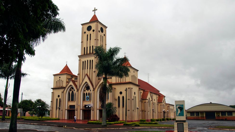
The name and legend of the route lives on in the town of Peabiru (Credit: Flavio Benedito Conceição/Getty Images)
Some theories date the route to around 400 or 500 CE; others suggest it goes back as far as 10,000 years ago to Paleo-Indian hunter-gatherers. “The Caminho de Peabiru was the most important transcontinental road in Pre-Columbian America, connecting people, territories and oceans,” said Dr Claudia Parellada, a Brazilian archaeologist who has published several academic papers on the subject and is a director of the Paranaense Museum in Curitiba where many of the remains from the trail’s archaeological digs are housed.
Theories diverge not just on when it was created but also where the exact route went. “We’re always going to have hypotheses,” explained Parellada. “Certainty about the complete route of Peabiru is difficult because it changed over time.”
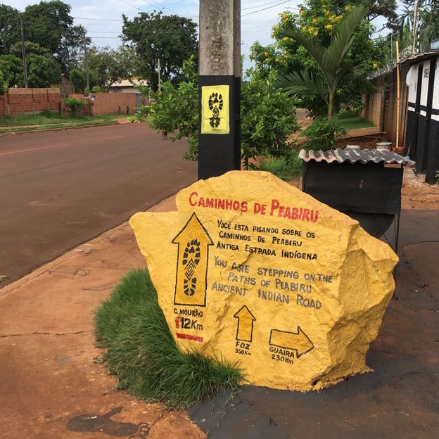
The name and legend, at least, live on in Peabiru, a town built in the 1940s, where local government and volunteer groups have recently created and signposted hiking routes inspired by the Caminho de Peabiru. They’re part of an ambitious state-wide tourism plan that launched this year, mapping out a plausible 1,550km hiking and cycling route for the Caminho right across Paraná state from the coast through 86 municipalities all the way to the Paraguayan border.
I’d travelled to Peabiru to test one of them out: a forest trail that takes in seven waterfalls along the course of a river. The banks of the river would almost certainly have been part of the Caminho de Peabiru, my guide Arléto Rocha told me as we walked, climbing under and over fallen trees and then wading up to our knees in the river’s cold water, washing the rotten fruit from my soles. Not content with just getting his boots wet, Rocha dived into a waterfall fully clothed. Further on, he pointed out spots where he’d found arrowheads, mortars, rock engravings and other archaeological gems over the past decade, now on display in the recently inaugurated Museu Municipal Caminhos de Peabiru.

Local Peabiru groups have created and signposted hiking routes inspired by the Caminho de Peabiru (Credit: Catherine Balston)
Most of the forest hike, like the broader state-wide route, is symbolic – an estimate at best of where the original route might have been, although there is more certainty on some stretches, especially where historical maps and archaeological sites exist. This region of south-west Brazil has been a hotbed of archaeological digs since the 1970s in the search for traces of the Caminho de Peabiru, as it was once dense with indigenous populations (estimated at around two million people, mainly Guaranis, at its peak in the 16th Century).
Like many others I’ve spoken to, Rocha is fixated on the mystery of the trail and even published his post-grad thesis on the subject. Historians, astronomers and archaeologists have also been puzzling over it for decades, piecing together old maps, colonial records and oral histories to try and understand the trail’s origins and purpose.
The general consensus is that the main route in the network connected the east and west coasts of South America: it began from three starting points on the coast of Brazil (in São Paulo, Paraná and Santa Catarina states) that joined up in Paraná, continued across Paraguay to silver-rich Potosí and Lake Titicaca in Bolivia, pressed on to Cusco (the capital of the Incan Empire) in Peru and then down to the Peruvian and northern Chilean coast.
“In broad terms, we can say that the path followed the movement of the setting and rising sun,” wrote Bond in her most recent e-book, História do Caminho de Peabiru, published last year.
In it, Bond analyses a number of plausible hypotheses about the origin of the trail, concluding that the network of paths was likely created and used by various indigenous groups over the centuries, but that its defining characteristic was a desire to connect the Atlantic and the Pacific. “It doesn’t matter how many and of which people built it, but that it was a road that in a certain moment was seen by the indigenous as a specific, homogenous path that represented on Earth the movement of the Sun in the sky,” she wrote.

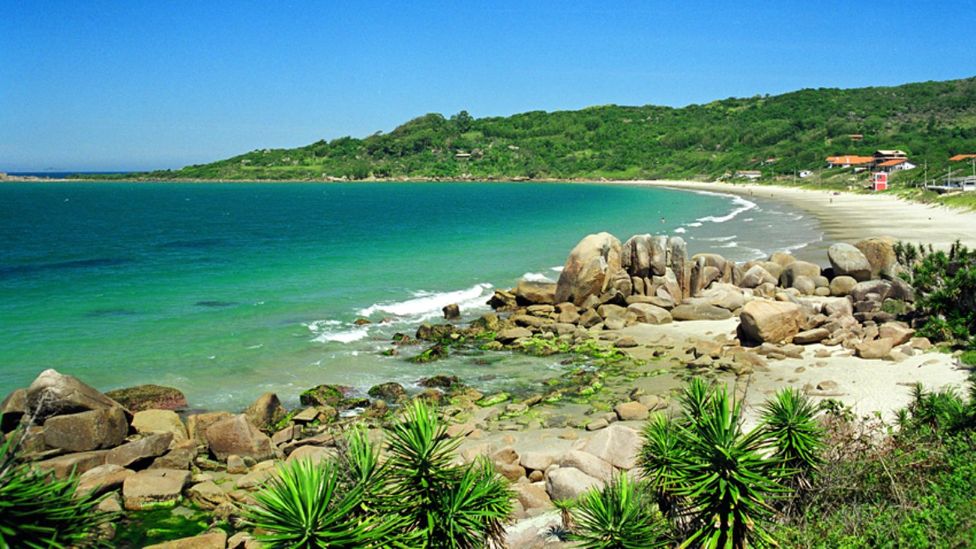
Santa Catarina is believed to be one of the Caminho de Peabiru’s three starting points (Credit: Flavio Santos)
The indigenous people that Bond refers to are the Guaranis, one of the largest surviving indigenous populations in South America, living across parts of Brazil, Argentina, Paraguay and Bolivia. The Caminho de Peabiru is a spiritual as well as a physical path in Guarani culture leading to a mythological paradise they call Yvy MarãEy, located across the water (the Atlantic) where the sun rises. This paradise (“the land without evil” in one translation) is referenced in Guarani oral history, rituals, music, dance, symbology and place names. Guarani legends even say that the network of paths is a reflection on Earth of the Milky Way. The trail’s name is also thought to come from the Guarani word peabeyú, meaning “path of trodden grass”, among other translations.
The Guaranis’ spiritual path to paradise became a fast track to riches for European invaders – such as Portuguese sailor Aleixo Garcia – on the New World expeditions that would ultimately lead to genocide of South America’s indigenous populations. Legends of El Dorado and the Sierra de la Plata (Mountain of Silver) brought Spanish and Portuguese flotillas across the Atlantic, and some indigenous groups helped them penetrate the interior of the continent along the Caminho de Peabiru, said Parellada. “Knowing the main routes and trails via the native populations became a strategic advantage, broadening the plundering, the destruction and the greed for new territories and mineral riches.”
Over the following centuries, successive waves of explorers, catechising Jesuits, bandeirantes (Portuguese slavers), traders and colonisers also used the Caminho de Peabiru to access the interior of the continent, paving it, widening it and sometimes changing its course along the way. “The earliest written records about the trail date to the 16th and 17th Centuries,” Padellada added, “They include Ruy Díaz de Guzmán’s 1612 account of Garcia’s death at the hands of the Payaguás ethnic group on his return to the coast from Peru.”
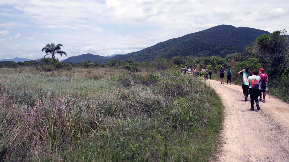
To continue my search for remnants of the trail, I travelled down to the coast of the neighbouring state of Santa Catarina to Enseada dos Britos, a tranquil bay where historians believe Garcia lived and from where he would have departed on his mission to the Incan empire. This is the starting point for yet another hike inspired by the Caminho de Peabiru, a 25km route that takes in beaches, the sand dunes of a state park and a visit to two Guarani villages. Limbering up for the 25km hike, I tried to picture Garcia and his band of unshaven, sunburnt castaways, thousands of miles from home, settling into their new Guarani digs here after losing their ship.

Inspired by the Caminho de Peabiru, Flávio Santos’ 25km route passes through the Serra do Tabuleiro national park (Credit: Catherine Balston)
Like the previous hike, the route is just an approximation of where the Caminho de Peabiru might have gone. It came about through the research of local businessman Flávio Santos, who developed this tourism project after studying the trail’s history and local archaeological sites. He, like so many others, sees the potential to attract year-round tourism that benefits the local community, including the nearby Guarani villages, if done the right way.
“We have this ancient trail, so why not connect history and the local indigenous people together? It’s important that local people know this story and know how the indigenous people lived and how they were decimated,” Santos said.
Parellada agrees: “Walking the Caminho de Peabiru, combined with educational activities, could be a bridge to a whole understanding of South America’s colonial past, its biodiversity and the knowledge of the indigenous people.”
—
Join more than three million BBC Travel fans by liking us on Facebook, or follow us on Twitter and Instagram.
If you liked this story, sign up for the weekly bbc.com features newsletter called “The Essential List”. A handpicked selection of stories from BBC Future, Culture, Worklife and Travel, delivered to your inbox every Friday.