Mt. Whitney: A perilous trek to the top of California’s record snowpack
Whitney #Whitney

MT. WHITNEY’S SUMMIT —
The final stretch of our climb to the top of California’s historic snowpack was so steep only the front points of our crampons were in contact with the mountain. Beneath our heels was nothing but air.
A fall from there, just below the 14,505-foot summit of Mt. Whitney, could have been fatal. A quick glance over my shoulder showed a tiny patch of baby blue — the first sign of melting — on an icy lake 2,000 feet below.
Don’t look down, I thought, just keep moving. I kicked one toe into the snow as firmly as possible, then the other a little higher, then hammered an ice ax into the snow a little higher still.
After what felt like an eternity, I reached up, wrapped my fingers over bare granite, and hoisted myself onto the summit. Dave Miller, a professional mountain guide who led the climb, snapped a photo and shook my hand.
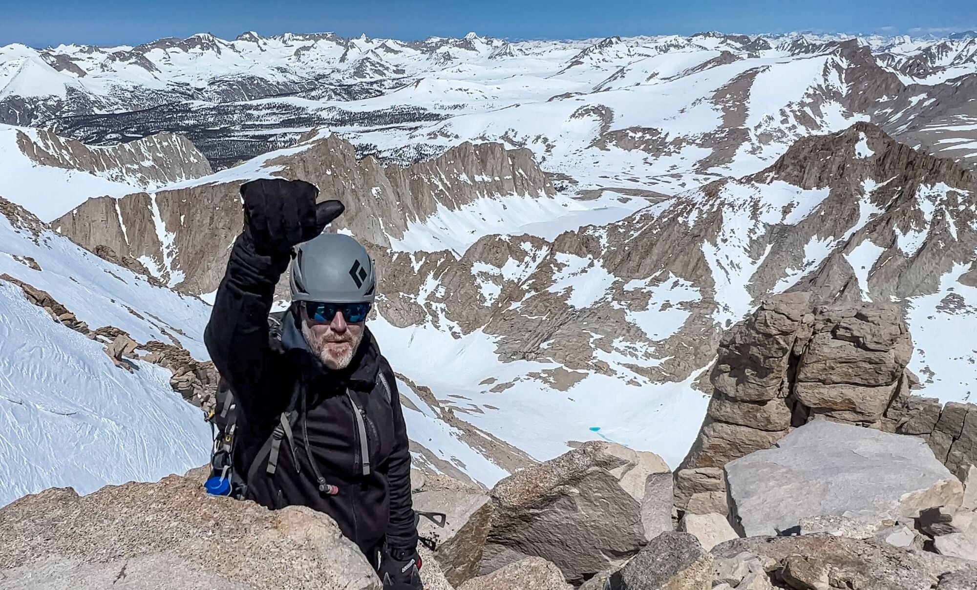
Jack Dolan reaches the top of the Mountaineer’s Route on the summit of Mt. Whitney.
(Dave Miller)
From where we stood, every remaining flake of the deepest California snowpack on record — 300% of what falls in a normal year — lay piled beneath our feet. A jaw-dropping ocean of white stretched to the horizon in three directions.
The southern Sierra Nevada holds so much frozen water this spring that California, a state that has become synonymous with perennial drought and wildfire, is bracing for potentially catastrophic floods. Farmers and public works crews are racing to shore up levees in the Central Valley. First responders are warning about the dangers of being swept away by typically placid rivers now raging with thunderous flows.
That sense of looming chaos hangs over Mt. Whitney’s climbing season too. As the highest point in the United States outside Alaska, it’s a bucket-list summit for outdoors enthusiasts around the globe. More than 100,000 people enter the lottery for famously coveted permits to climb Whitney each year.
Even without much snow, the standard hike to the summit is a punishing physical ordeal: more than 20 miles round-trip with over 6,000 feet of elevation gain into a stark lunar landscape. But in normal conditions, you at least can travel light: Last June, I made the climb in a pair of sturdy trail runners and a fleece.
This year, summiting Whitney is a full-on winter mountaineering expedition, requiring much of the gear you’d see in a Mt. Everest documentary — and the expertise to use it in an emergency. It means dodging avalanches, plowing forward through waist-deep snow, and navigating rapidly deteriorating snow bridges that span rushing, often unseen streams.
View of Mt. Whitney, right, outside of Lone Pine. (Brian van der Brug / Los Angeles Times)
Since the official start of climbing season on May 1, thousands of hikers who won the lottery for hiking permits have bowed to the conditions and changed their plans.
Still, some people — including some dangerously unprepared people — have made it to the top and posted tales of their triumphs on social media. Veteran mountaineers and search-and-rescue teams worry it’s only a matter of time before others unversed in the perils follow in their steps only to meet with disaster.
In late May, Miller and I hoisted heavy bags full of climbing gear at the Whitney trailhead, 8,400 feet, and slowly worked our way up to survey the historic snowpack. Hopefully, our experience can offer a window into an extraordinary spring in the Sierra — while also serving as a cautionary tale of what lies ahead as summer approaches and more climbers try their luck.
::
Mt. Whitney, about four hours north of Los Angeles, is the tallest point in a breathtaking wall of granite that rises more than 10,000 feet, almost straight up, from the high desert in eastern California.
It towers over an enormous, mostly barren landscape strewn with the ancient scars of violent geologic upheaval. The lowest point in the continental United States is just over 100 miles away in Death Valley.
There are much prettier mountains in California. The perennially snow-capped Mt. Shasta is surrounded by lush pine forests and it’s only a few hundred feet lower. But when it comes to bragging rights, altitude is king, so there’s no substitute for Mt. Whitney.
For our climb, Miller and I skipped the 20-plus mile Whitney Trail, the most common route up, and opted for the roughly nine-mile Mountaineer’s Route. First climbed by John Muir in 1873, it is steeper and much more direct, so it limited our exposure to the obvious hazards.
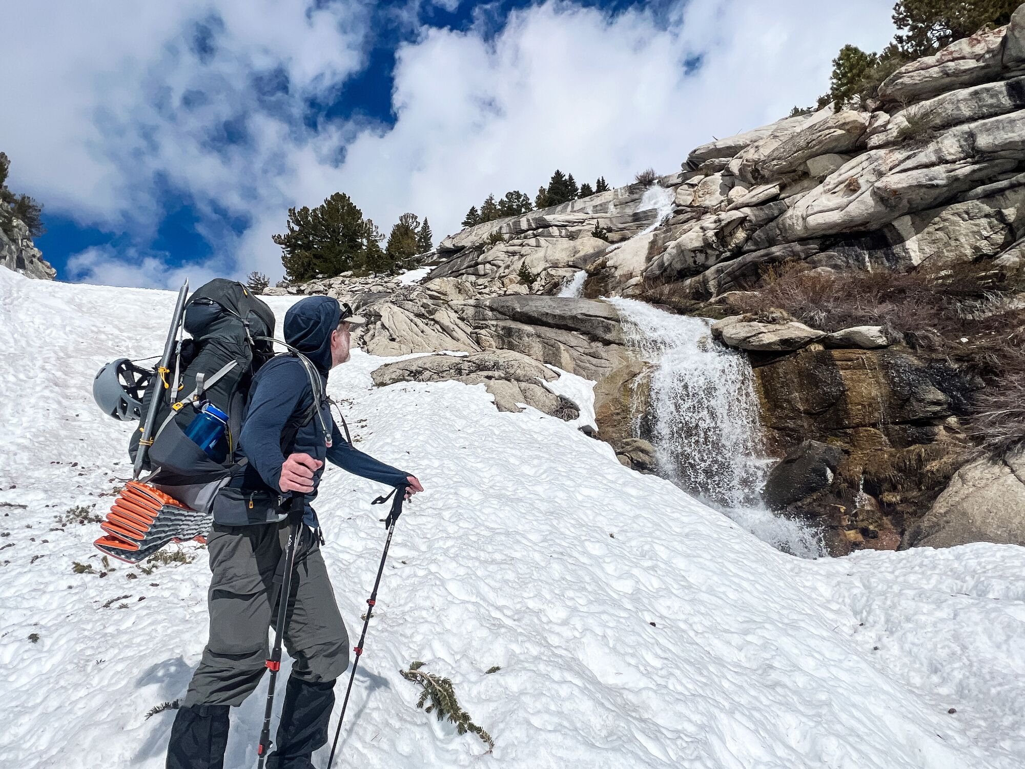
Less than an hour in, the dirt trail ended at the bottom of a gully on the North Fork of Lone Pine Creek, a steep section where water runs between high rock walls on either side. The gully was littered with hundreds of scattered pine branches and a slab of snow the consistency of concrete, telltale signs of a recent avalanche.
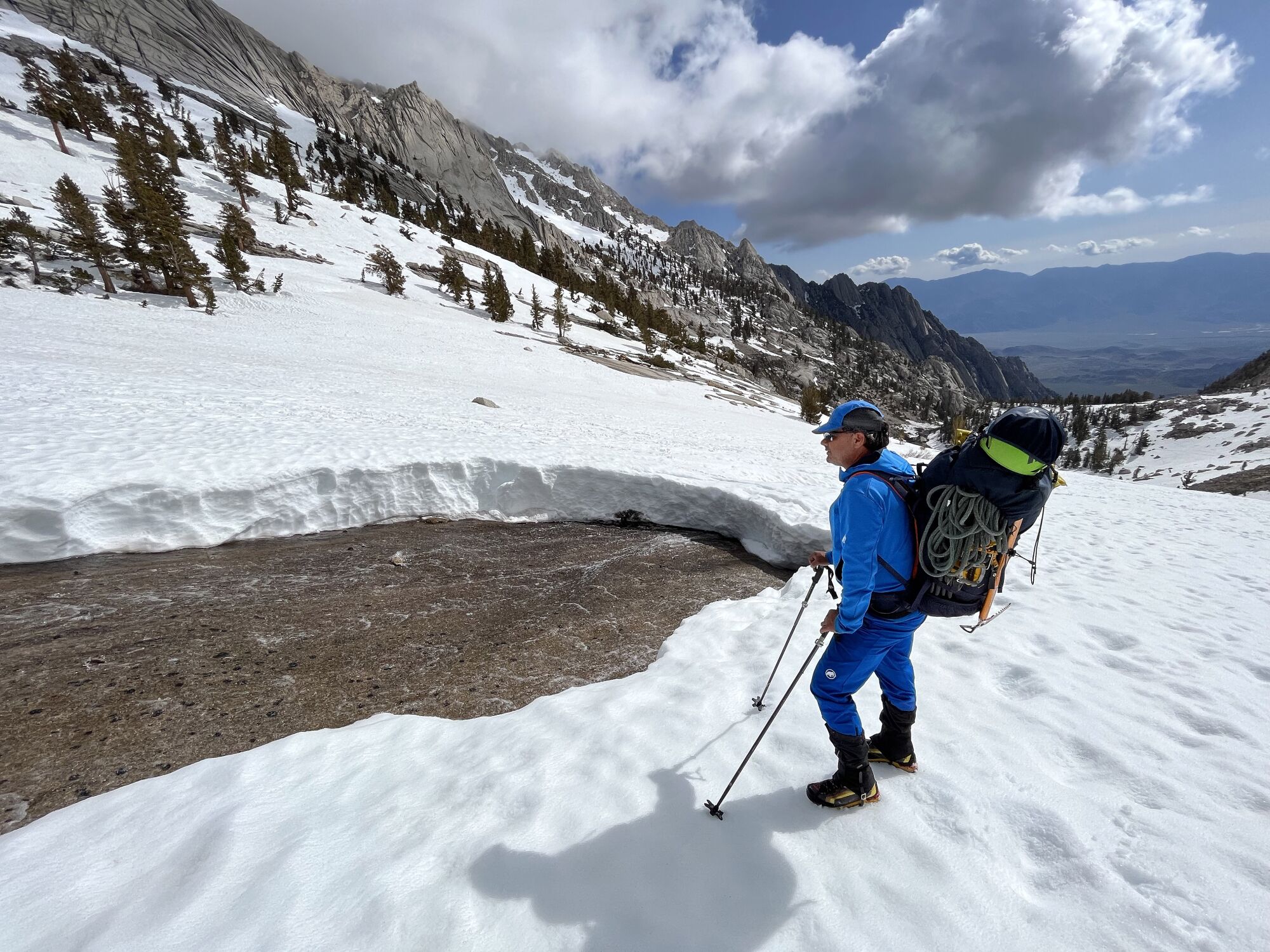
Guide Dave Miller surveys a stream exposed after a snow bridge collapsed on Mt. Whitney. Just hours earlier, the stream was concealed by snow.
(Jack Dolan / Los Angeles Times)
While the surface was firm, we could hear the snowmelt-swollen creek rushing under our feet. That meant we were standing on a bridge made of snow. If you’re on a snow bridge when it collapses — and they all collapse eventually — you can be swept away and trapped beneath the snow and ice. The risk of drowning or freezing to death is real.
Given the danger, Miller told me to wait while he went ahead, sticking to the thickest section of the avalanche debris and probing in front of each step with his hiking poles. He unbuckled the straps on his backpack to make it easier to wriggle out, just in case.
After crossing in complete silence, he turned and told me to unbuckle the straps on my pack and follow exactly in his footsteps.
We gingerly climbed several hundred feet like that, stopping and starting as I traced his steps along the edge of the gully where the snow seemed thickest. We crossed the middle of the gully — where the stream usually runs — only when necessary.
In the days before our climb, that gully was the stretch that worried him most, Miller said. Even though it’s relatively low on the mountain, it’s where snow was melting fastest and where conditions were most unstable. As the season progresses, that band of danger is bound to move steadily uphill.
After about five hours of climbing, we reached our destination, Upper Boy Scout Lake, at 11,400 feet. Climbing in the afternoon is risky because the warming surface loosens rock and ice. When we stopped talking, we could hear falling debris in the distance.
The lake provided a flat, safe spot away from steep walls to camp and wait for morning. We found a small, dry rock outcrop with a level patch just big enough for our tent.
As soon as the sun ducked behind the summit, the temperature plummeted below freezing and wind came howling down from the surrounding peaks. We quickly added layers: long underwear, puffy down jackets, gloves, beanie caps.
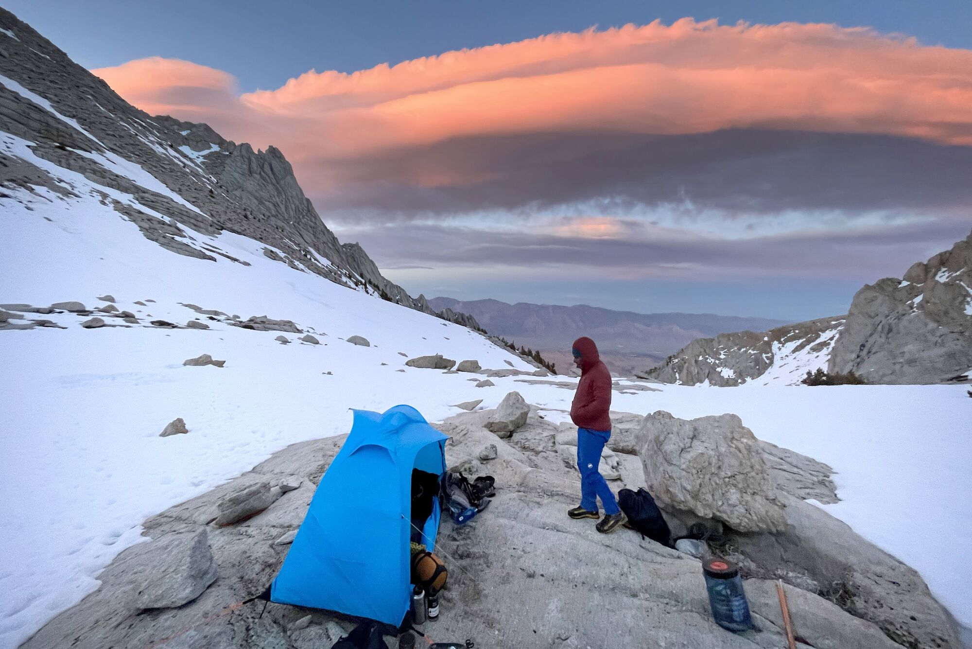
A cloud known as a Sierra Wave appears at last light on Mt. Whitney.
(Jack Dolan / Los Angeles Times)
At last light, a spectacular pink, undulating cloud — known as a Sierra Wave — appeared in the east. These long, thin strands form when wind collides with the almost vertical granite wall of the mountain range and rises quickly and the airborne vapor condenses. Above it, we saw nothing but dark blue. Below it, lights twinkled in the town of Lone Pine 8,000 feet below.
::
Winter mountaineering is a constant race against rapidly changing snow conditions. Too soft on the way up and you’ll slide back down with every step, making the climb a miserable slog. Too firm on the way down and the slightest slip can quickly turn into an unstoppable fall.
And there’s always the unexpected. Last year, a professional guide died and two of her clients were severely injured after they slipped and fell nearly 2,000 feet on a usually forgiving route up Mt. Shasta. The culprit? Light precipitation the night before that had left an almost invisible, but exceptionally hard and slick layer of ice on the mountain. It was like “a donut glaze,” according to the U.S. Forest Service ranger who came to their aid.
When Miller and I crawled from our tent at 4 a.m. on the second day of our climb, the elements seemed to be cooperating. The freeze overnight had left a firm, sandpaper-like crust on top of the snow. Instead of sinking into it, we could walk across the surface with excellent traction.
Wearing headlamps to light the way, and with our packs lighter because we left the camping gear behind, we made great time to Iceberg Lake, at 12,600 feet. That’s where the Mountaineer’s Route turns dramatically upward, a ribbon of snow and ice climbing steeply between two massive rock towers.
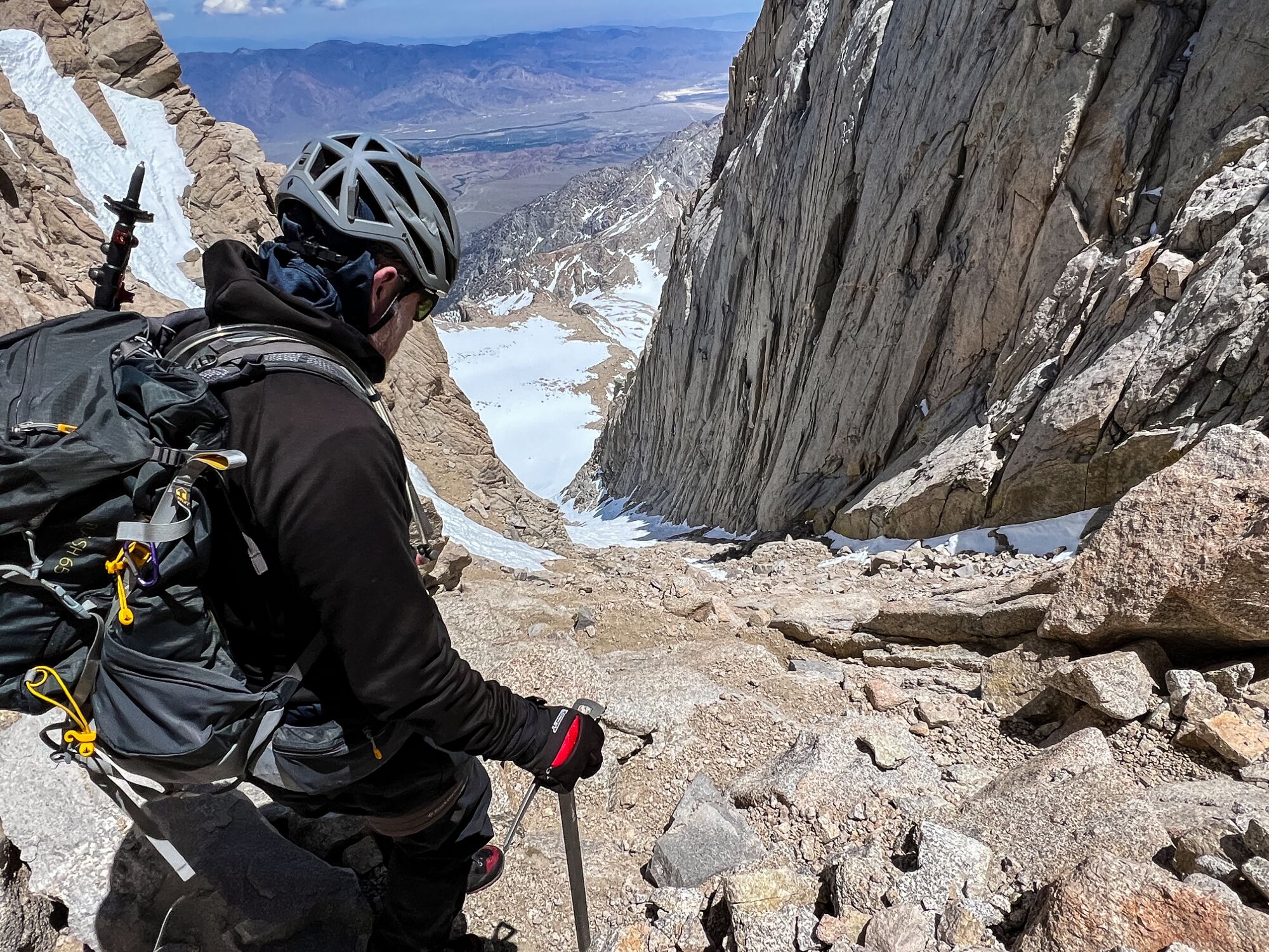
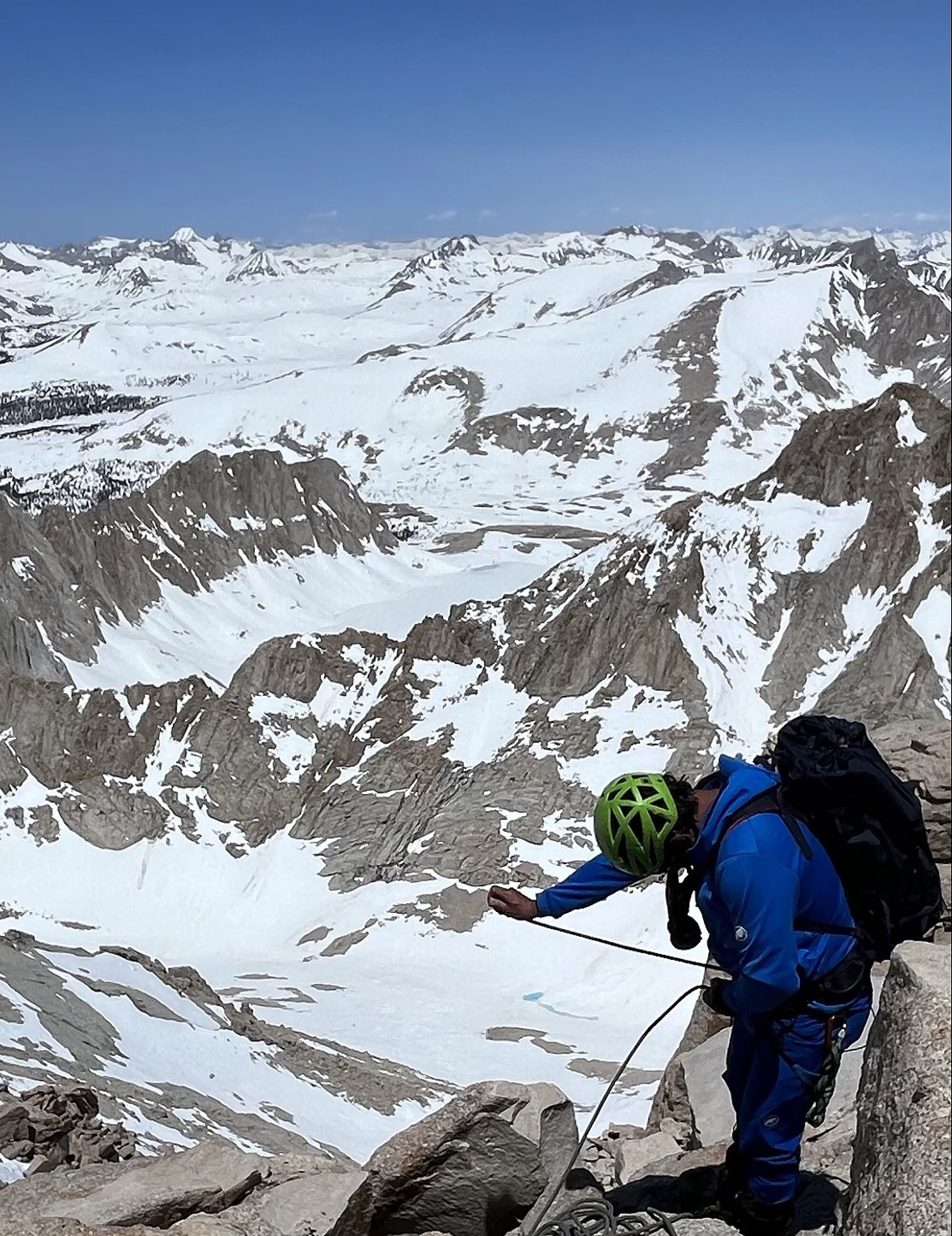
Jack Dolan descends a steep chute on the Mountaineer’s Route of Mt. Whitney.
(Dave Miller)
The sun had just come up, so we stashed the headlamps and put on helmets to protect against falling rock and ice. We strapped crampons to our boots and traded trekking poles for ice axes, lethal-looking tools designed to hold you in place on steep terrain.
As we started up the chute, our crampons made a satisfying crunch with all 10 spikes on each foot burying themselves for maximum hold.
The next few hours were like being on a StairMaster with a magnificent view. Breathing got a little harder as the air thinned above 13,000 feet, but we made “the notch,” a small flat spot at just over 14,000 feet, by 10 a.m. Above the notch were the notorious “final 400” feet of the Mountaineer’s Route, a much steeper chute where a fall might end in the frozen lakes thousands of feet below.
Miller, who has spent 22 years leading clients up summits around the world, sounded confident as he pulled a 40-meter rope out of his pack. He said he’d never seen the final 400 so “beautifully” full of snow.
He tied one end of the rope to a harness around his waist and the other to a harness around mine. He would lead, climbing until the rope was stretched almost as far as it could go, and then find a spot on the side of the chute where he could brace himself against the rocks. I would follow. If I slipped, the rope would save me.
The unspoken downside of the plan was if he fell and couldn’t stop himself, he might rocket past me and I would have a second or two to watch the rope follow him, and reconsider my choices, before I got yanked down too.
We put our lives in other people’s hands all the time: a pilot, a surgeon, even our friends and family when they’re behind the wheel and we’re in the passenger seat. It’s so commonplace we don’t obsess about how vulnerable it makes us.
But there’s nothing commonplace about being tied to someone above a frozen abyss.
The unsettling possibilities were still running through my head when Miller started climbing. Even with only the front points on each of his crampons in contact with the snow because the terrain was so steep, he moved quickly and calmly — like someone climbing a ladder to clean the gutters.
I was slower and clumsier. My calves screamed, a blister on my right heel burned with every other step. But I didn’t slip.
It took four pitches, or lengths of the rope, and about an hour before we reached the summit.
I’d been there three times before, via the longer Whitney Trail, but I had never seen so much snow. It didn’t look like California on the brink of Memorial Day weekend. It looked like the North Pole.
To our surprise, we weren’t alone.
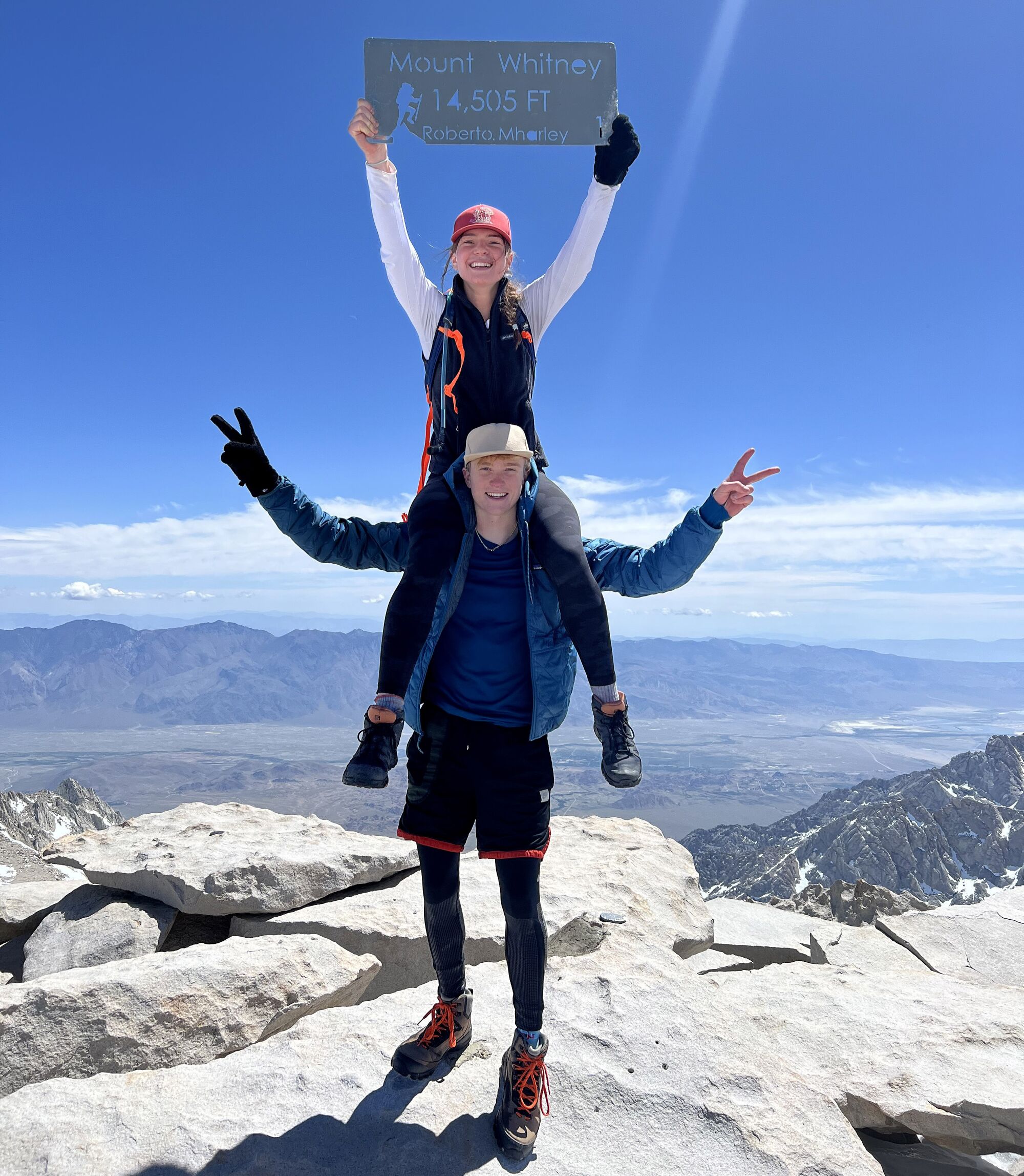
Carson Severson and Sofia Goodwin, San Jose State students, celebrate at the summit of Mt. Whitney.
(Jack Dolan / Los Angeles Times)
Carson Severson and Sofia Goodwin, teenage college students from San Jose State, were there too. Ultramarathoners, they had all but sprinted up the Whitney Trail in about six hours, impressive time. But they were traveling dangerously light: no helmets, for example, and no ice axes.
Neither had climbed Whitney before. They had entered the permit lottery on a whim and gotten lucky, so they decided to give it a try despite the record snowpack.
“Our parents were like, WTF,” Severson said while catching his breath.
His mom had rented crampons that they used on the steeper sections of the trail, he said. In a couple of those spots, he found himself praying, “Oh God, please, please.”
The only other person on the summit, Brandon Riza, from Orange County, has been climbing, running and skiing in the Sierra for 20 years. He said he expected a nightmare of inexperienced climbers needing rescue this season, but so far, most people were heeding the advice from public safety officials to stay within their limits.
Along with all the usual winter mountaineering equipment, Riza also had a pair of skis. For decades, he’d been dreaming of skiing off the highest summit in the Lower 48. “When it was dumping [snow] so much this winter, I was like, this is the year I’m going to do it,” he said.
Just before we parted ways, Severson mentioned that he and Goodwin needed to get down fast to meet his mom and asked if the Mountaineer’s Route was an option.
“Absolutely do not try that,” I said. The veterans in the group knew, as it was, that their return trip down the more forgiving Whitney Trail would require some measure of luck.
After wishing each other well, it was time to leave. The summit is only half the journey, and it’s a bad idea to waste daylight in the mountains.
As Severson, Goodwin and Riza headed west, Miller and I roped up and stepped off the steep ledge to the east.
Guide Dave Miller ties into a rope for safety before his descent from the summit of Mt. Whitney.
(Jack Dolan / Los Angeles Times)
I went first, with Miller anchoring himself above to belay me with the rope. On the second or third pitch, the rope got caught on a loose rock about the size of a bowling ball. As I climbed down, the jostling dislodged it. Miller shouted, “ROCK!”, and I braced myself. I’ve heard that warning a few times over the years, and have always been lucky.
Not this time.
The rock slammed into my helmet with a deafening bang. It was no glancing blow. I’d absorbed the full force. When I opened my eyes, the rock was resting in the snow in front of my face.
Without the helmet, I’d have been gravely injured: a bloody 170 pounds of dead weight dangling from the rope. But once I got over the shock, I felt OK.
We got back to the notch at about 1:30 p.m. By that time, the snow had turned soft. So we were able to “plunge step” down the next chute, taking long strides and landing on our heels, which would then slide several feet until the snow compacted beneath them. It sounds dangerous, but in such soft snow, you’re not likely to fall far, especially with an ice ax in your hands. We covered so much ground with every stride, we descended in 30 minutes what had taken us about two hours to climb.
But when the terrain flattened out, our luck turned. No longer aided by the pull of gravity, we started sinking up to our thighs with every step, a situation known as “post-holing”. Each step became a monumental struggle. We spent at least an hour moving as if we were in quicksand. Even with waterproof boots and pants, the lower halves of our bodies froze, while the upper halves roasted in the afternoon sun.
Miller took it stoically; I whined. At one point, he turned and shouted back up the hill, “You wanted to write a story about the ‘big melt,’ right? You’re hip deep in it now!”
Rapid snowmelt cascades off rocks on Mt. Whitney.
(Dave Miller)
By far the most dangerous part of our descent was the return trip through the gully. In the short time since we’d come up, giant holes had emerged in the avalanche debris. Now, we could see the rushing water beneath.
We stuck to the cliffs above the gully, making a slow and careful rock-climbing descent along a series of narrow catwalks known as the Ebersbacher Ledges. It required delicate footwork, especially with heavy packs. In spots, a fall could have been disastrous. But at least we trusted the rock not to dissolve beneath our feet.
From the bottom of the chute, it was an easy hike on dirt to the parking lot, where we dropped our packs and gleefully traded our boots for flip-flops.
My outdoor resume is long and varied, including multiple climbs of snowy peaks, but I would not have attempted Whitney in those conditions without someone as experienced as Miller.
As for the college students we met on the summit, luck was on their side — mostly.
With the snow so soft and forgiving in the afternoon, they ran much of the way down the Whitney Trail, Severson said in a phone interview a couple of days later. When they fell, they stopped themselves by digging in their heels and elbows.
But the mountain was changing rapidly. At one point, they encountered fresh avalanche debris across the trail that hadn’t been there during their ascent. At another, they realized they were on a snow bridge across a cascading stream they hadn’t noticed on the way up.
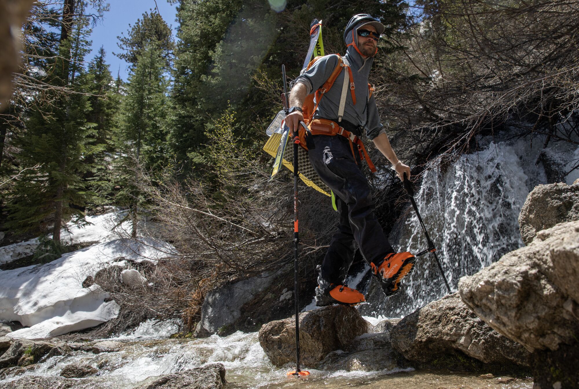
Backcountry skier Remy Michele crosses the North Fork of Lone Pine Creek.
(Brian van der Brug / Los Angeles Times)
“So much changes in just five hours,” Severson said.
But they didn’t escape completely unscathed.
Severson hadn’t brought sunglasses and didn’t consider the threat of snow blindness until the drive home, when he felt like “screaming.” He wound up in an emergency room with sunburned corneas, a painful condition that cleared up with medication after a visit to an ophthalmologist.
“I kind of just did this whole thing on a whim,” he said.
Riza realized his decades-long dream of skiing off the Whitney summit. He had to take the skis off and hike a couple of sections near the top, where the snow was blown off the trail, but he managed to ski an almost unbroken line from about 13,000 feet to the parking lot.
“While you guys were post-holing, I was probably drinking a beer,” he said.
He was relieved when I told him a temporary case of snow blindness was the worst that had happened to the couple from San Jose State. He’d been worried about them since he first encountered them on the way up.
“I’ve been involved in rescues before, I’ve seen the bloody messes,” he said. “People have died exactly where they were standing because they didn’t have the right equipment.”
